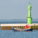
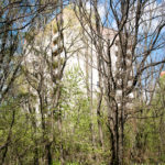
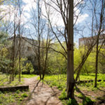
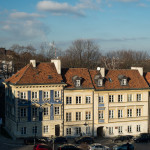
More information about the Youngtimer Warsaw initiative:


Below are the pictures I took during the travel photography workshop organised by Nikon’s Academy in Poland (Fotografia w podróży). I am still internalizing the knowledge, skills and inspiration gained during the workshop and promise to do my best to implement it while taking pictures in the future.
I almost pledged to myself that I’d start waking up before sunrise every weekend to take pictures – luckily, the common sense took over quickly :).
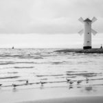
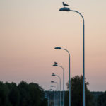
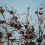
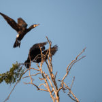
The workshop was held in the picturesque island of Karsibór of the Oder Lagoon near Świnoujście, home to a number of bird species, including cormorants and sea eagles.
Some of my workshop photos were also posted on the blog of Nikon’s Academy: https://www.akademianikona.pl/blog/wpis/fotografia-z-podrozy-13-15-maja-2016


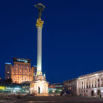
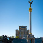
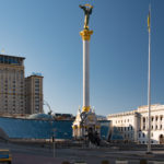
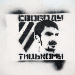
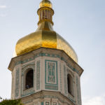
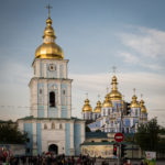
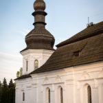
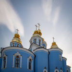
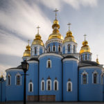
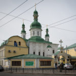
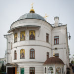
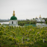
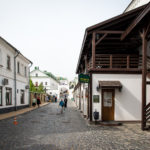
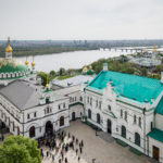
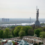
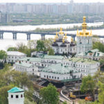
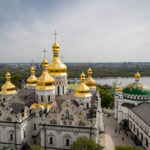
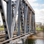
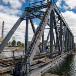
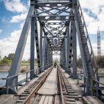
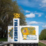
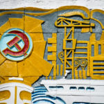
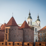
Pictures taken during my brief stay in Kiev.


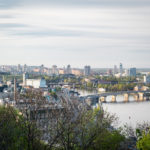

I took so many pictures which I could not resist sharing that this post had to be split into ten parts – click on a link below to jump to the relevant section:
If you would like to find out more about Chernobyl:
If you would like to visit Chernobyl yourself, it is neither very complicated nor expensive – you need to get to Kiev and book a trip with one of the companies organising the Chernobyl tours. I used SoloEast Travel (http://www.tourkiev.com/) for a one-day tour and I highly recommend them: my trip was very well organised and included all the Chernobyl/Pripyat landmarks I wanted to see.
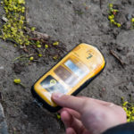
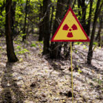
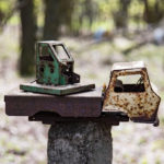
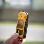
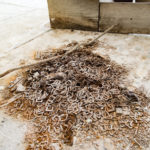
The pictures below show the kindergarten of Kopachi (копачи), a small town near Chernobyl, which was completely torn down due to extremely high level of contamination. The radiation level in the air is normal (0.13 μSv/h), but if you touch the soil with the Geiger counter, it quickly hits 13 μSv/h – a hundred times more.


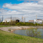
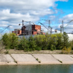
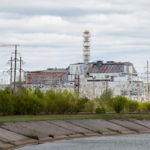
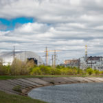
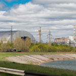
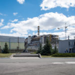
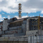
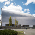
In the pictures below you can see the damaged reactor No. 4, which is now covered by the Sarcophagus, a concrete structure hastily built in the months following the accident and estimated to endure approximately 30 years. A new one is now being built, the so-called New Safe Confinement (more: http://www.economist.com/news/science-and-technology/21633793-almost-three-decades-after-catastrophe-wrecked-it-proper-tomb). It is expected to endure approximately 100 years (which, compared to the half-life of the plutonium and uranium isotopes contained in the magma of the melted reactor No. 4, is close to a blink of an eye). The level of radiation next to the monument near the power plant is now approximately 3 μS/h – this is because the asphalt of the road and the square next to the power plant was removed and replaced several times. The trees of the nearby Red Forest, however, were not, and the forest remains to be one of the most contaminated radioactive places on Earth (it absorbed so much radiation in the aftermath of the accident that it changed its color from green to red).
In 1986, the Chernobyl Nuclear Power Plant (V.I. Lenin Nuclear Power Station) consisted of four 1,000-MW reactors. Two more were being built at the time and one of the images below depicts the construction site of the reactor No. 6, abandoned a couple of months (but, interestingly, not immediately) following the disaster.
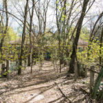
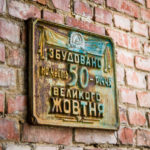
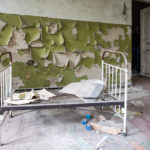
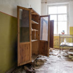
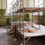
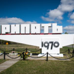
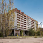
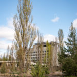
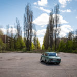
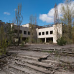
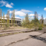
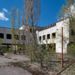
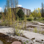
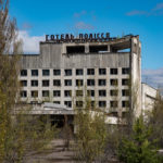
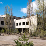
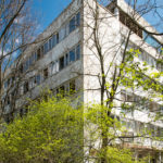
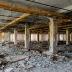
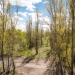
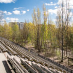
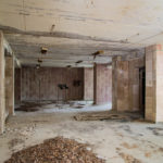
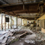
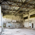
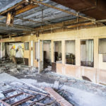
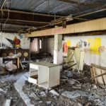
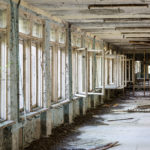
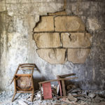
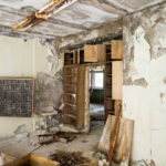
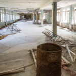
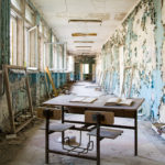
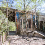
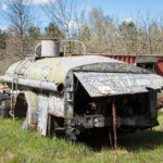
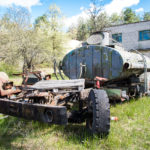
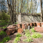
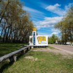
Pripyat (При́п’ять) was established in 1970 and designed as a nuclear city, to serve as a home for the workers of the Chernobyl Nuclear Power Plant. Almost 50,000 people lived there immediately before the accident. It is now totally abandoned, located within the 10-km strict Exclusion Zone.


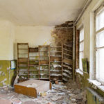
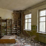
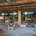
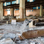
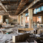
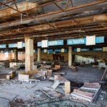
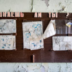
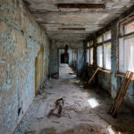
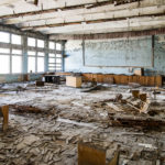
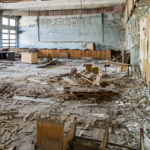
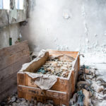
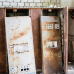
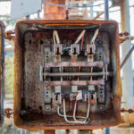
The pictures below show the looted interior of the main supermarket in Pripyat. When you look at the top floor, you stop wondering why it is said that in late 1980s some goods in the marketplaces of the Soviet Union were not bought without having been checked with a Geiger counter first.


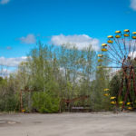
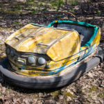
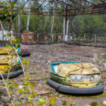
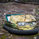
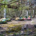
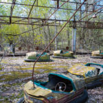
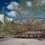
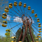
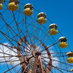
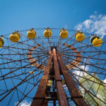
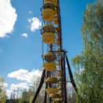
The Pripyat amusement park was to be opened on 1 May 1986 (the May Day celebrations) but such plans were interrupted as the disaster occurred. The park is said to have been opened for just a couple of hours to keep the people entertained before the announcement to evacuate the city was made. The amusement park is one of the places in Pripyat you may recognize from the Call of Duty 4: the Modern Warfare video game.
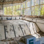
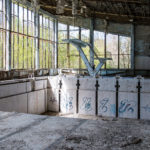
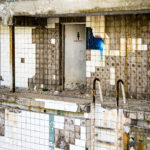
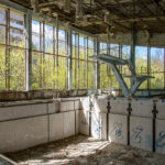
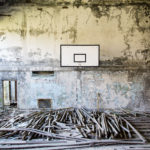
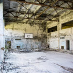
The swimming pool is one of the best-recognized landmarks in Pripyat. According to Wikipedia, it was still in use by the liquidators in 1996, ten years after the accident. It was also one of the landmarks in the Call of Duty 4: The Modern Warfare video game (if you would like to see how good a job the creators of the game did in replicating the actual swimming pool, see this video: https://www.youtube.com/watch?v=xq-KSdC10C8).

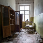
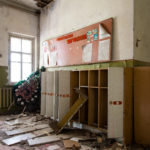
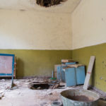
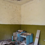
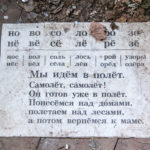
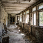
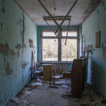
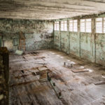
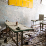
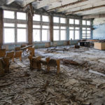
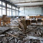
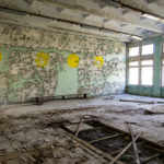
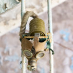
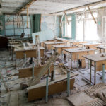
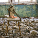
Middle School Number 3, located in the Sportivnaya Street, close to the swimming pool, houses probably the most photographed collection of gas masks in Pripyat. The shape and architecture of the school was quite similar to the schools I remember from my childhood, probably based on some Soviet design.


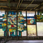
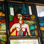
Pripyat cafe on the bank of the river Pripyat was probably a popular place among the inhabitants of the city. Its architecture contrasts with the plain and simple blocks of flats surrounding it and the stained-glass-decorated interior stands out when compared to bare furnishings of other public utility buildings.


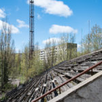
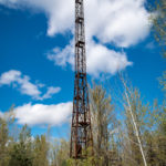
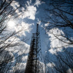
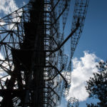
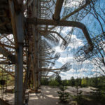
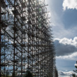
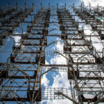
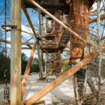
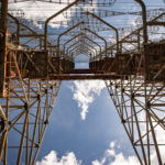
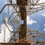
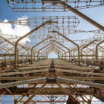
Duga (Дуга) near Chernobyl was part of a Soviet over-the-horizon radar system used as part of the early-warning network. The Duga system was extremely powerful and consumed enormous amounts of energy, which partly explains why it was situated a couple of kilometres from a nuclear power plant. It disrupted the broadcast in the shortwave radio bands, appearing without warning and sounding like a sharp, repetitive tapping noise at 10 Hz, which led to it being nicknamed by shortwave listeners the Russian Woodpecker. According to the satellite images, the length of the low-frequency antenna of the radar system was 460 meters, height — almost 150 metres (the length of the high-frequency antenna was 230 meters and its height – 100 meters). The Duga radar was considered to be top secret until two years ago, when it was open for visitors and is now part of the regular trip to Chernobyl.
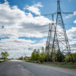
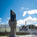
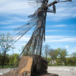
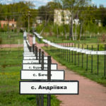
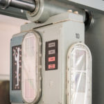
Before leaving the town of Chernobyl, you get to see a monument commemorating the nearby towns and villages which had to be evacuated following the disaster in order to create the two-tier Exclusion zone (strict exclusion with a radius of approximately 10 km around the reactor and the wider one with a radius of 30 km). You will not be permitted outside of the Zone without passing the radiation scan. However, I am not sure I put much trust in the accuracy of the 30-year old Soviet-era scanning devices and got rid of the shoes I wore during my trip.
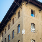
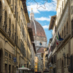
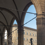
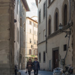
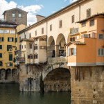
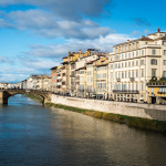
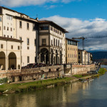
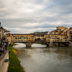
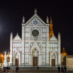
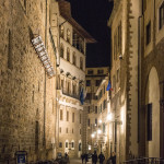
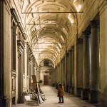
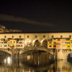
Pictures of the capital of Tuscany – the city of Florence.


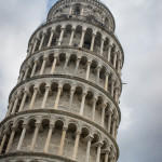
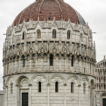
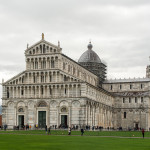
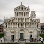
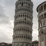
Pictures of Pisa:

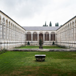


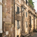
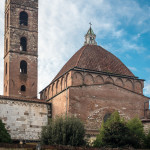
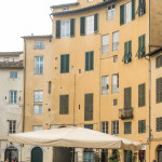
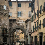
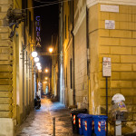
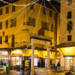
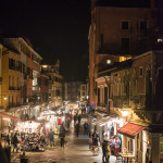
Pictures of Lucca and its surroundings:

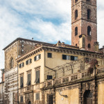


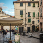

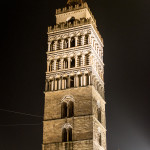
Pictures of Pistoia:

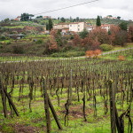
Pictures of the Azienda Agricola Luca Michelozzi:


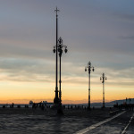
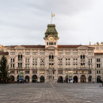
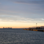
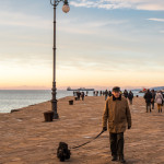
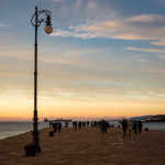
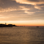
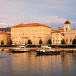
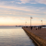
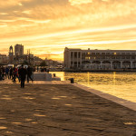
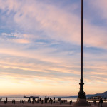
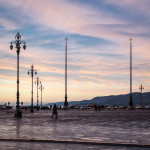
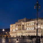
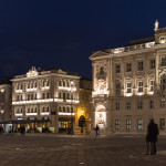
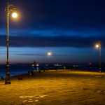
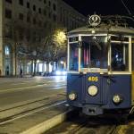
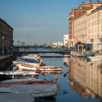
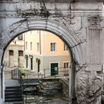
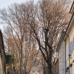
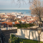
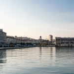
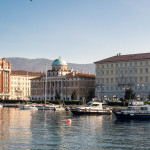
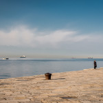
Pictures from Trieste – La città del caffè and the capital of the region of Friuli Venezia Giulia, which formally joined Italy only in 1954.


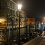
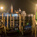
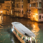
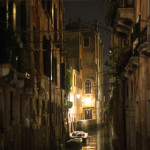
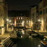
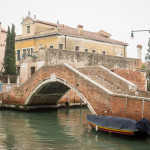
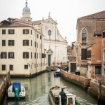
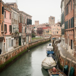
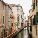
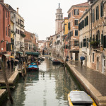
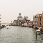
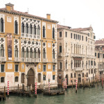
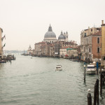
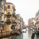
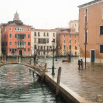
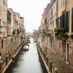
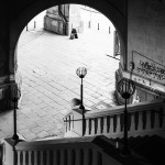
Our trip to Italy at the beginning of the year allowed me to briefly see Venice which I did not encounter the first time I was there: cold, rainy, dark and, what is most important, almost without tourists.


Good news: after two years of hesitation, I have finally decided to purchase a full-frame (FX) camera, Nikon D610. See below a couple of pictures I took during my first walk with it:

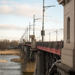
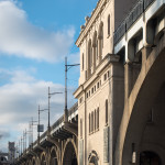
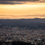
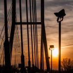
Zachód słońca nad centrum Warszawy widziany z Mostu Siekierkowskiego.
Sun setting over Warsaw downtown, as seen from the Siekierkowski bridge.


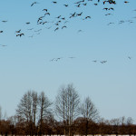
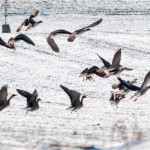
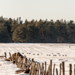
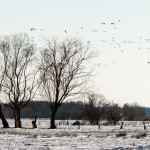
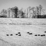
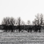
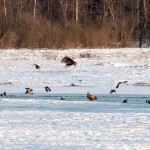
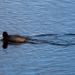
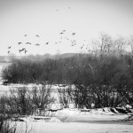
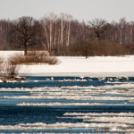
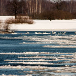
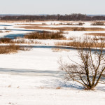
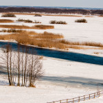
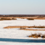
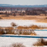
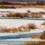
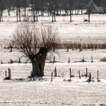
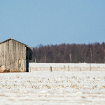
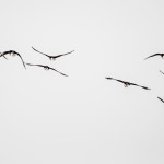
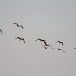
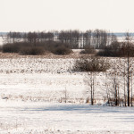
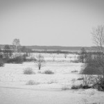
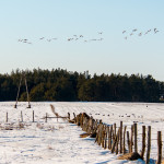
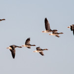
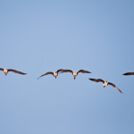
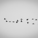
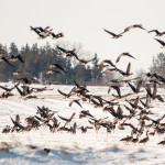
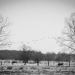
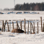
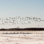
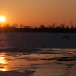
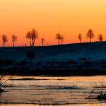
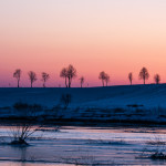
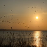
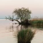
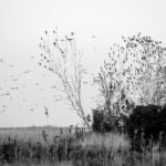
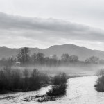
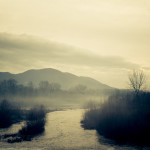
Some pictures from my archives, taken in March 2013 during my trip to the region of Biebrza and Narew in northeast Poland.
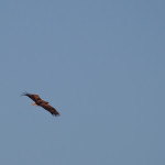
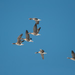
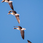
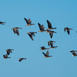
Just 170 kilometres from the Warsaw city centre, the second half of March witnesses an extraordinary show. The Biebrza Marshes are a traditional travel stop for various species of migrating birds, including the greylag geese and cranes. The geese travel in flocks of from a couple of dozen thousand up to a few hundred thousand birds. Depending on the size of the flock, they can literally cover the entire sky. The Biebrza Valley is considered by the BirdLife International organisation to be an Important Bird and Biodiversity Area of worldwide importance and the Biebrza National Park is protected under the Ramsar Protection on Wetlands. The marshes are a habitat for, among others, greylag and white-fronted geese, wigeons, northern pintails, tundra swans (yellow-nosed), black storks, spotted eagles, white-tailed eagles and eagle-owls. Seeing them or taking pictures of them in their natural habitat is an extraordinary experience.
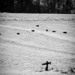
The thickets are also home for mooses, which generally went extinct in Poland during the Second World War and only a few of them survived in the Red Marsh Natural Reserve located in the Biebrza Valley. As of today, there are a couple of hundred mooses in the region (approximately four hundred according to official sources and approximately seven hundred according to unofficial ones). If you are patient and equipped with properly insulated clothes, in the evening, just after the sunset, you will have a chance to see beavers and, if you are really lucky, wolves.
The best way to visit the Biebrza Marshes is to hire a qualified guide. There is an official list of such guides at the websites of the Biebrza National Park (see below). My recommendation is to go with the “Biebrza Eco Travel” company (see address below).
More about the Biebrza Valley:
Zaledwie 170 kilometrów od centrum Warszawy co roku w drugiej połowie marca przyroda organizuje spektakl, o którym wiedzą nieliczni. Rozlewiska Biebrzy i Narwi są bowiem przystankiem dla licznych ptaków wędrownych. Wśród ciszy rozlega się odgłos kluczących po niebie dzikich gęsi, żurawi i innych ptaków. Gęsi wędrują w stadach liczących nawet kilkadziesiąt lub kilkaset tysięcy osobników. W zależności od roku stada te potrafią przesłonić praktycznie całe niebo. Dolina Biebrzy została uznana przez BirdLife International za ostoję ptaków o randze światowej, a Biebrzański Park Narodowy jest na liście Konwencji Ramsarskiej. Na bagnach występują m.in. świstun, łabędź krzykliwy (z żółtym dziobem), bocian czarny, orlik krzykliwy i grubodzioby, puchacz czy bielik. Zobaczenie ich w naturalnym środowisku lub sfotografowanie jest niezapomnianym przeżyciem.
Wśród zarośli spotkać można łosie, które kilkadziesiąt w trakcie drugiej wojny światowej wyginęły w Polsce i przetrwały jedynie w położonym w Kotlinie Biebrzańskiej ścisłym rezerwacie bagiennym Czerwone Bagno. Dziś w dolinie Biebrzy jest ich kilkaset (oficjalnie: ponad 400; nieoficjalnie: ponad 700) osobników. Wieczorami nad wodą cierpliwi i ciepło ubrani zaobserwują również bobry, a naprawdę wytrwałym tropicielom może uda się odnaleźć wilka.
Wyprawy zorganizowane: Najlepszym rozwiązaniem jest uczestnictwo w zorganizowanej wycieczce lub wynajęcie przewodnika, który oprowadzi (lub obwozi) nas po rozlewiskach i pokaże co ciekawsze miejsca. Ich dane kontaktowe dostępne są na stronie Biebrzańskiego Parku Narodowego (http://www.biebrza.org.pl/67,przewodnicy.html); z czystym sumieniem polecić mogę firmę Biebrza Eco Travel (http://biebrza.com).